
Click HERE and HERE for an update concerning the marginal severe weather threat today.
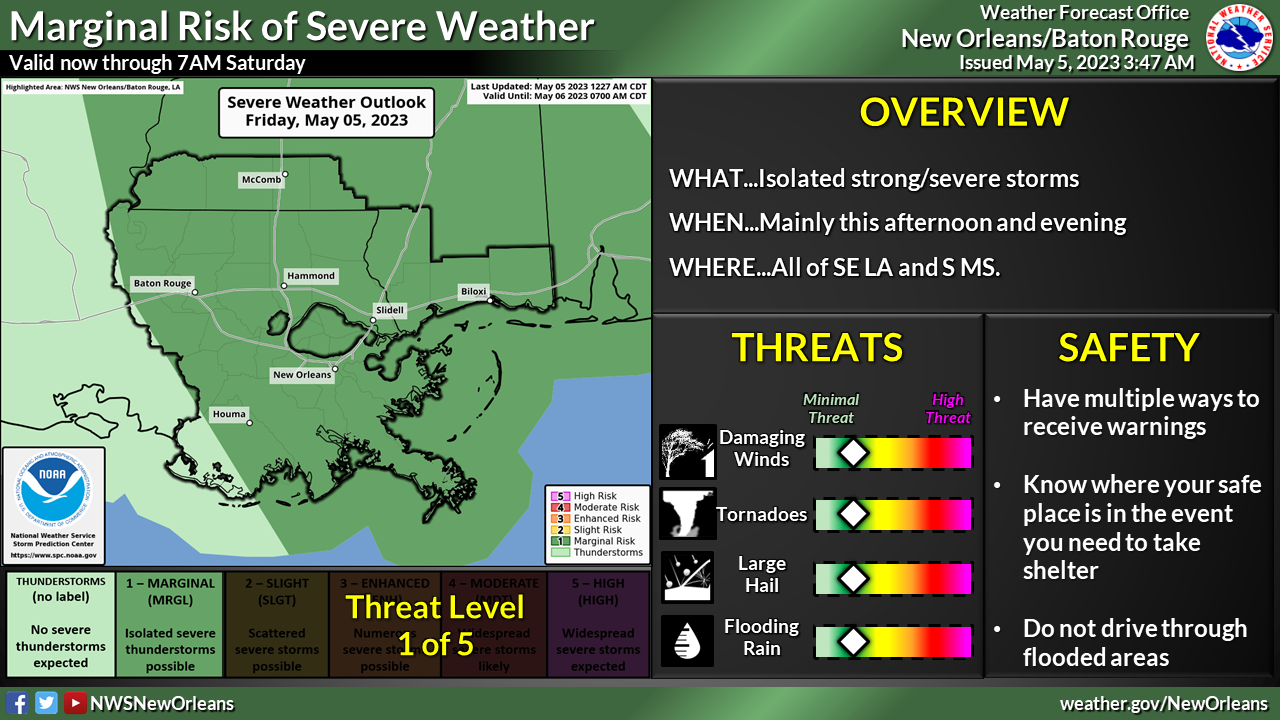
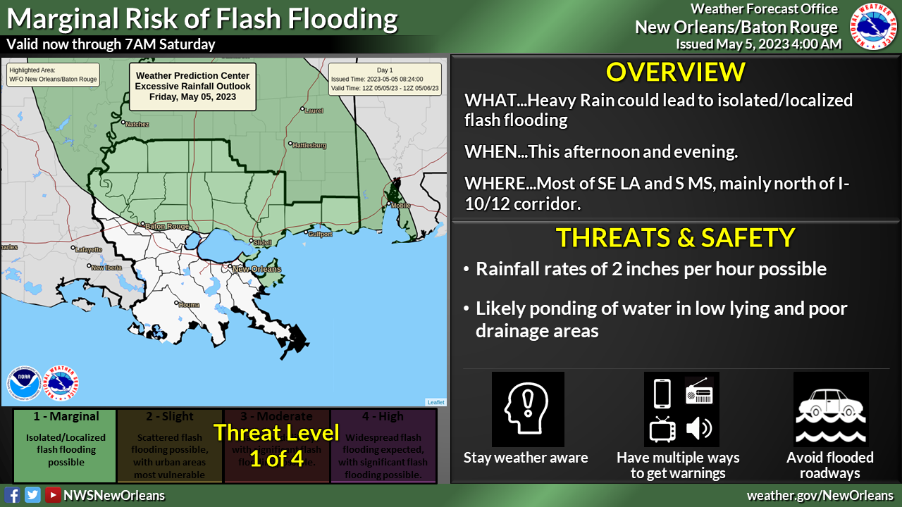
Changes from previous update: The area of greatest threat has expanded to our entire forecast area.
Overview:
WHAT: MARGINAL RISK of Severe Weather and Excessive Rainfall
WHEN: This afternoon and evening
WHERE: All of our forecast area covering southeast Louisiana and southern Mississippi
CONFIDENCE: We are fairly confident that there will be thunderstorms across the area and that a few will be strong to marginally severe. We have less confidence in exactly where those strong/severe storms will occur.
Impacts:
The main threats associated with any severe storms will be:
- Damaging Winds: Wind gusts greater than 50 mph will be possible.
- Large Hail: Large hail up to 1 inch in diameter will be possible. Wind-blown hail could cause additional damage
- Tornadoes: A few weak tornadoes can’t be ruled out.
- Heavy Rainfall: Rainfall rates up to 2″ per hour are possible leading to flash flooding and ponding of water in low lying areas.