Southeast Louisiana and Southern Mississippi partners –
Here is an update concerning the severe weather threat today:
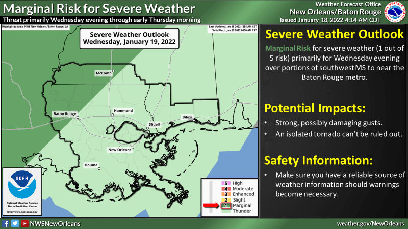
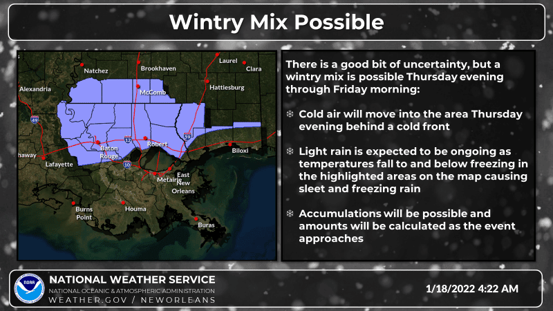
WHAT: MARGINAL RISK of Severe Weather and WINTRY MIX of sleet and freezing rain possible
WHEN: Marginal risk for severe weather mainly starting Wednesday evening through early Thursday morning. Wintry mix could start Thursday evening and remain through Friday morning.
WHERE: Marginal risk for severe weather mainly over sections of SELA and near the Baton Rouge metro area. Wintry mix could develop mainly along and north of the Interstate 1/12 corridor
CONFIDENCE: Moderate confidence in severe storms. Moderate confidence in the potential for a wintry mix, the uncertainty of this event is with timing, areal extent, and amounts
The main threats associated with any severe storms will be:
- Locally strong, possibly damaging winds.
Tornadoes:
- An isolated tornado will be possible.
The main impacts from a wintry mix could be the icing of some roadways especially elevated roadways and structures. Amounts associated with this scenario will be calculated as the event approaches.
The attached graphics highlight the threats associated with this system.


Additional Information and Resources:
NWS New Orleans Website: www.weather.gov/neworleans
NWS New Orleans DSS Website: http://www.weather.gov/lix/
River Gauges and Forecasts: http://water.weather.gov/
NWS New Orleans Facebook: www.facebook.com/NWSNewOrleans
NWS New Orleans Twitter: https://twitter.com/
Online Severe Weather Reporting: https://www.weather.gov/lix/
Storm Prediction Center: www.spc.noaa.gov
Next Update and Contact Information:
The next update will be Wednesday morning unless significant changes occur. If you have any questions in the interim or need additional information, please do not hesitate to contact us. We can be reached by phone at 504-522-7330 or 985-649-0429. Use extension 4 to speak with a forecaster. Alternatively, you can reach us by email by replying to this message or sending an email to [email protected]. Both methods will be delivered to the forecasters on shift at the office.


