
Click HERE and HERE for an update concerning the severe weather and flash flood risk this Friday into Friday night:
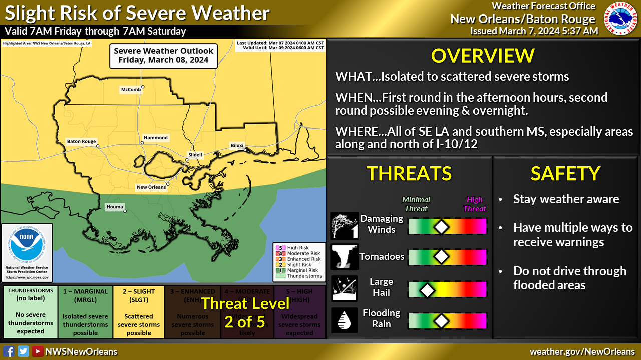
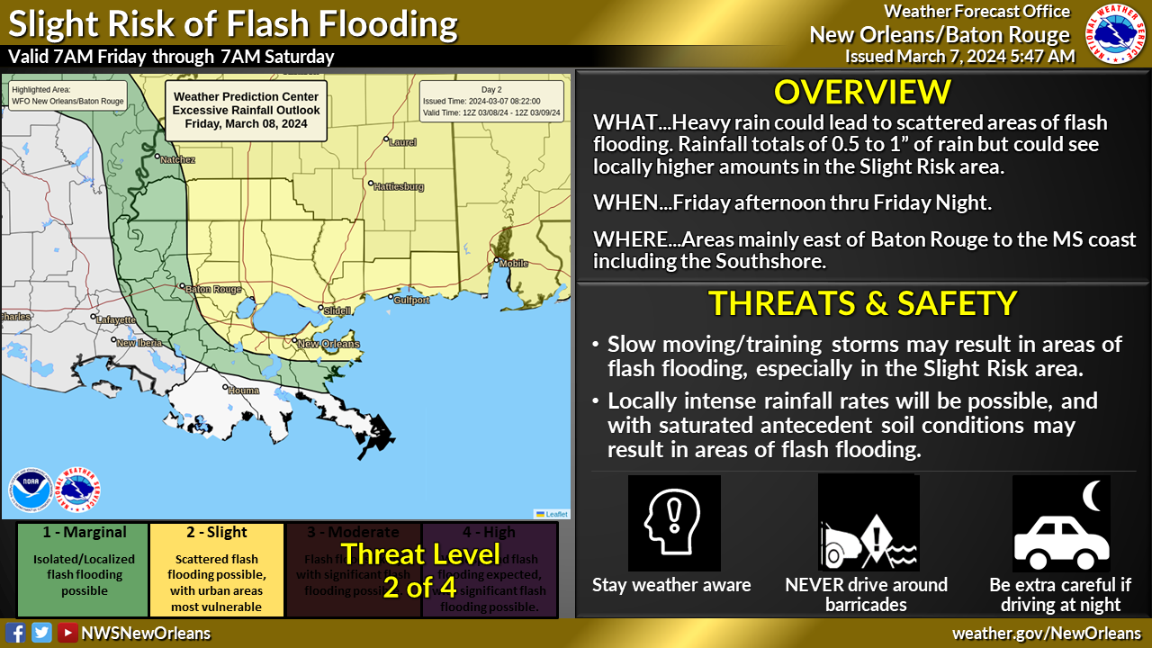
Overview:
WHAT: MARGINAL to SLIGHT RISK of Severe Weather & Excessive Rainfall
WHEN: First round: Primarily Friday afternoon, with a second round possible in the evening to overnight hours.
WHERE: All of Southeast LA and Southern MS, especially areas along and north of I-10/12.
CONFIDENCE & ADDITIONAL DETAILS:
- Confidence has increased with the potential for a first round of strong to severe storms generally in and around the Slight Risk area Friday afternoon. There are indications of a second round, although has the potential to be less widespread in the evening/overnight hours reaching the MS coast after midnight.
- Confidence for damaging wind gusts and a few tornadoes has increased slightly, with the risk for areas of flash flooding decreased slightly.
Look for more information & details pertaining to timing and risks in subsequent updates.
Impacts:
The main threats associated with any strong to severe storms will be:
- Strong, damaging wind gusts greater than 60 mph
- Large hail up to 1″ in diameter
- A few isolated tornadoes
- In addition to the severe weather threat, storms will be slow to progress east and may result in training over the same areas that may cause isolated areas of flash flooding.


