Southeast Louisiana and Southern Mississippi partners
Changes from the previous update:
- Addition of winter weather variables and a *Winter Weather Advisory may be issued later today*
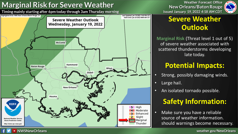
WHAT: MARGINAL RISK of Severe Weather and WINTRY MIX of sleet and freezing rain possible.
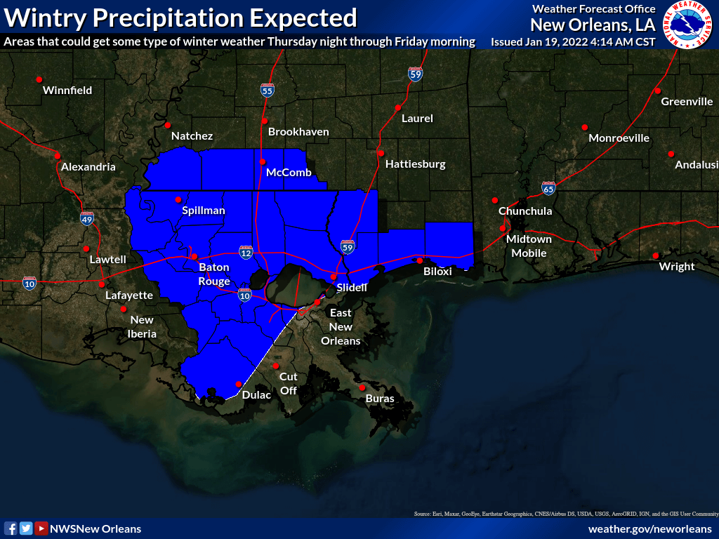
WHEN: Marginal risk for severe weather mainly starting after 6 pm today through 3 am Thursday morning. Wintry mix could start late Thursday evening and remain through Friday morning.
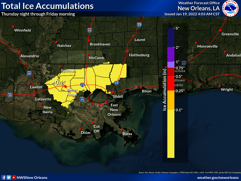
WHERE: Marginal risk for severe weather mainly over sections of southwest Mississippi and near the Baton Rouge metro area. A freezing rain, sleet mix could develop mainly along and north of the Interstate 10/12 corridor, while freezing rain is not expected south of this line, sleet could fall in these areas.
CONFIDENCE: Moderate confidence in severe storms. Moderate confidence in the potential for winter weather, the largest uncertainty of the winter event is the areal extent.
Impacts:
The main threats associated with any severe storms will be:
Damaging Winds:
- Locally strong, possibly damaging winds.
Hail:
- Hail to 1″ possible.
Tornadoes:
- An isolated tornado will be possible.
Winter weather:
- Areas that receive freezing rain could see up to .10″ of icing on some roadways especially elevated roadways and structures. A winter weather advisory may be issued for these areas later today.
The attached graphics highlight the severe weather threats associated with this system.
The 2 graphics below highlight the winter weather threats for Thursday night/Friday morning.
Additional Information and Resources:
NWS New Orleans Website: www.weather.gov/neworleans
NWS New Orleans DSS Website: http://www.weather.gov/lix/
River Gauges and Forecasts: http://water.weather.gov/
NWS New Orleans Facebook: www.facebook.com/NWSNewOrleans
NWS New Orleans Twitter: https://twitter.com/
Online Severe Weather Reporting: https://www.weather.gov/lix/
Storm Prediction Center: www.spc.noaa.gov
Next Update and Contact Information:
The next update will be at the 2 pm webinar today. If you have any questions in the interim or need additional information, please do not hesitate to contact us. We can be reached by phone at 504-522-7330 or 985-649-0429. Use extension 4 to speak with a forecaster. Alternatively, you can reach us by email by replying to this message or sending an email to [email protected]. Both methods will be delivered to the forecasters on shift at the office.


